Driving Directions
~Driving Directions to Big Bear Lake, CA~

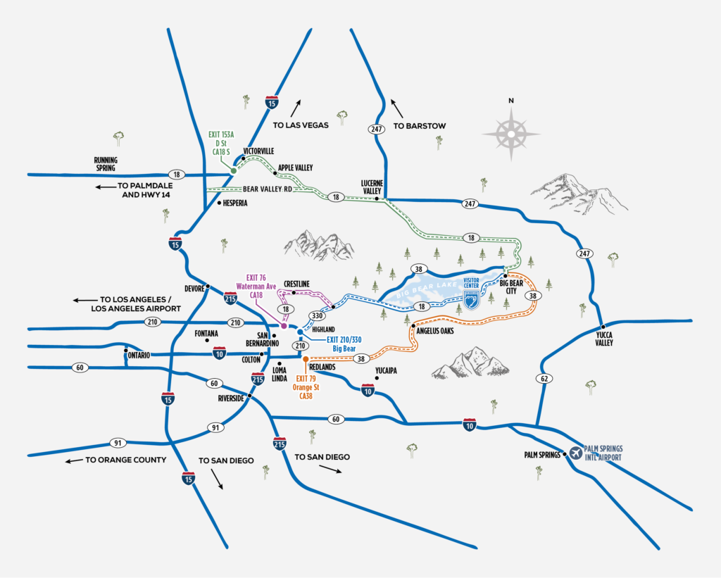
There are 3 main routes up the mountain:
- Hwy 38, which comes up from Redlands and brings you into the east end of the valley. This is the longest road by mileage, but typically moves a bit faster than the other 2 routes due to less tight curves. This route hits the highest elevation in the valley, so typically has chain requirements in the winter time even if there isn’t much snow falling in the city.
- Hwy 330 to hwy18 which comes up from Highland and brings you into the west end of the valley. This tends to be one of the more popular routes, which often times means more traffic, but also has conveniences like a gas station and restaurants on your way up the mountain road.
- Hwy 18 through the high desert which comes up from Lucerne Valley and brings you into the east end of the valley. This is the shortest section of mountain road, with just over 7 miles of mountain curves. This end of the valley typically sees the least amount of snowfall and is often the last to have chain requirements. If coming from the LA, Orange County or San Diego Areas, taking the 15 freeway over the Cajon Pass is the best way to utilize this route, alternatively Hwy 14 may give you good access from LA or Northern California.
Weather in Big Bear can change quickly, make sure you carry chains from November through April or when snow is forecasted outside of those months. Practice putting on your chains prior to coming up, so you don’t struggle if they become necessary. If travelling in the winter months, make sure to head up with a full tank of gas, blankets, water and snacks in case you hit some traffic. Also, a flashlight and gloves are great to keep in the car when traveling during potentially hazardous conditions.
Here is a link with reliable information on road conditions and traffic incidents: https://socalmountains.com/roads/
Ben’s weather tends to have to most accurate predictions about upcoming weather: http://www.bensweather.com

